
Reed Canarygrass Research Program
The Reed Canarygrass Research Program (RCRP) is a long-term ecological research program focused on measuring stream health parameters in relation to the colonization and management of the invasive plant reed canarygrass (Phalaris arundinacea).
Why it’s important


Reed canarygrass threatens riverine and wetland functions, biodiversity, and habitats, as it rapidly colonizes aquatic ecosystems.
This non-native grass outcompetes and displaces native plants, leading to a degradation of overall habitat conditions and biological diversity. Colonization alters habitat structure and functions by creating dense monocultures with thick sod root systems. Reed canarygrass can alter water velocity, temperature, and sedimentation. Depending on the environment, reed canarygrass has the potential to fill stream channels and wetlands, or lead to channel incision by hardening banks with the thick sod roots. Yet, few studies have investigated the mechanisms or efficacy of reed canarygrass to degrade critical salmonid habitat in the Pacific Northwest.
This program is intended to be of benefit to all restoration efforts and invasive plant managers in the Pacific Northwest region, offering opportunity for an improved and targeted effort to control invasive reed canarygrass.
Attributes of Interest
Water & air temperature
Dissolved oxygen
Flow velocity
Sediment characteristics
Light availability
Plant cover
Wilson Creek Study Site
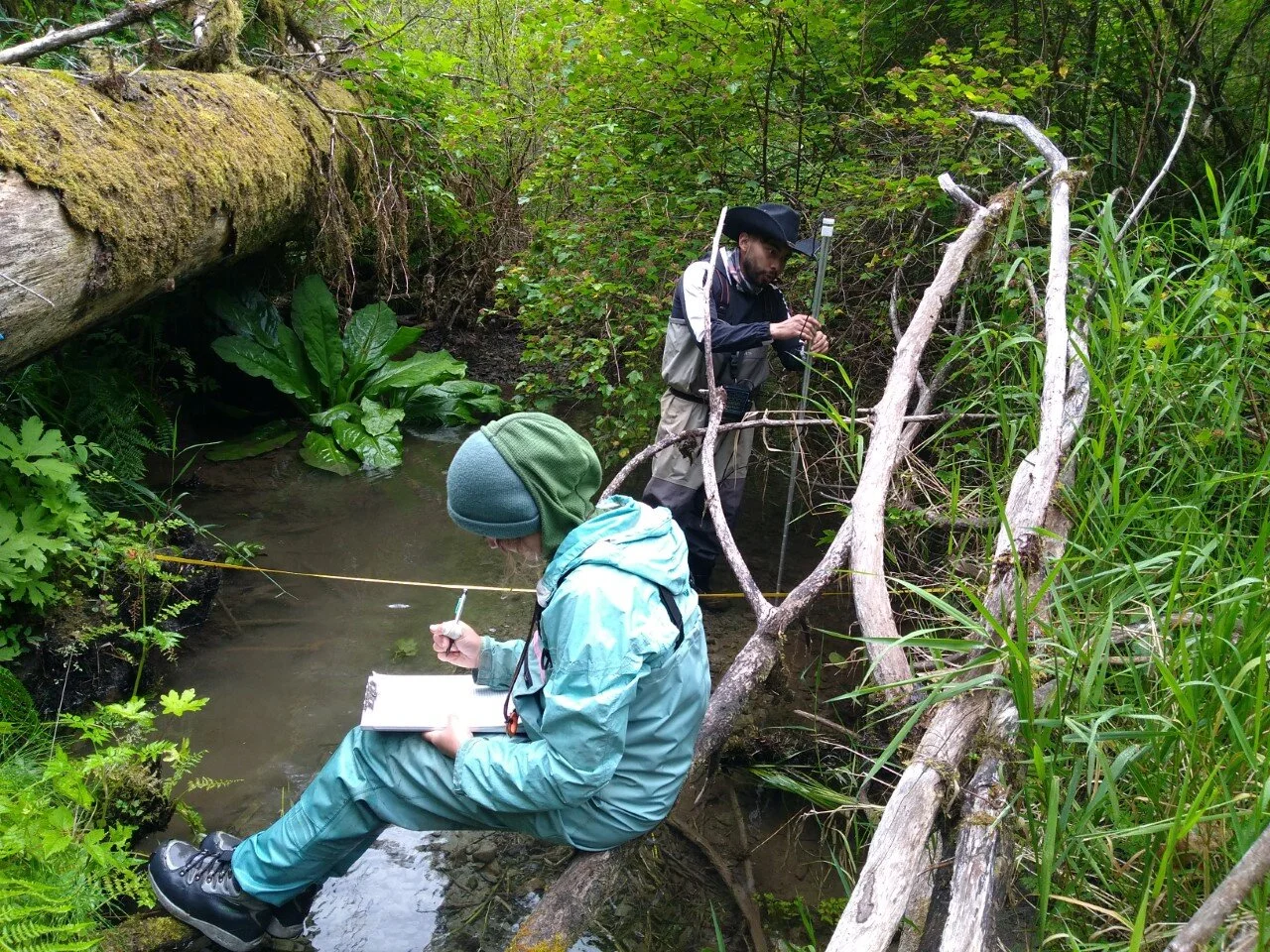
Currently, 10KYI’s Reed Canarygrass Monitoring Program is in its second year of data collection. In 2019, a pilot study was implemented (funded by Coast Salmon Partnership) on Wilson Creek, a tributary to the Bogachiel River in Clallam County. The pilot study established 6 cross-stream transects within an approximately 200-meter reach of Wilson Creek. These transects delineate where vegetation surveys, and light availability (photosynthetically active radiation or PAR for short) measurements are collected. They also serve as a reference point for dissolved oxygen and flow measurements. As the transect crosses the stream, sensors have been installed to collect the temperature of the water at regular, twenty-minute intervals.

Irely Creek Study Site
In 2020, a second study location established along a 600-meter reach of Irely Creek, a tributary to the Quinault River within the Big Creek drainage of Olympic National Park. Following lessons learned from the pilot study, standard operating procedures were updated and ten cross-stream transects were installed. The Irely Creek study location will be the model for future site installations and subsequent sampling procedures. Information on the Irely Creek study location may be found here.

Moving Forward
10KYI will continue to collect data at Wilson Creek and Irely Creek. As resources allow, this program will be expanded to monitor ten or more sites across the Olympic Peninsula.